Earth Observation
NASA publishes nighttime view of Arnab’s approach to India
The NOAA-20 observation was taken early on October 27 IST; the IMD’s October 29 bulletin tracked the cyclone’s inland remnant.
Add us as a preferred source on Google Add us as a preferred source on Google
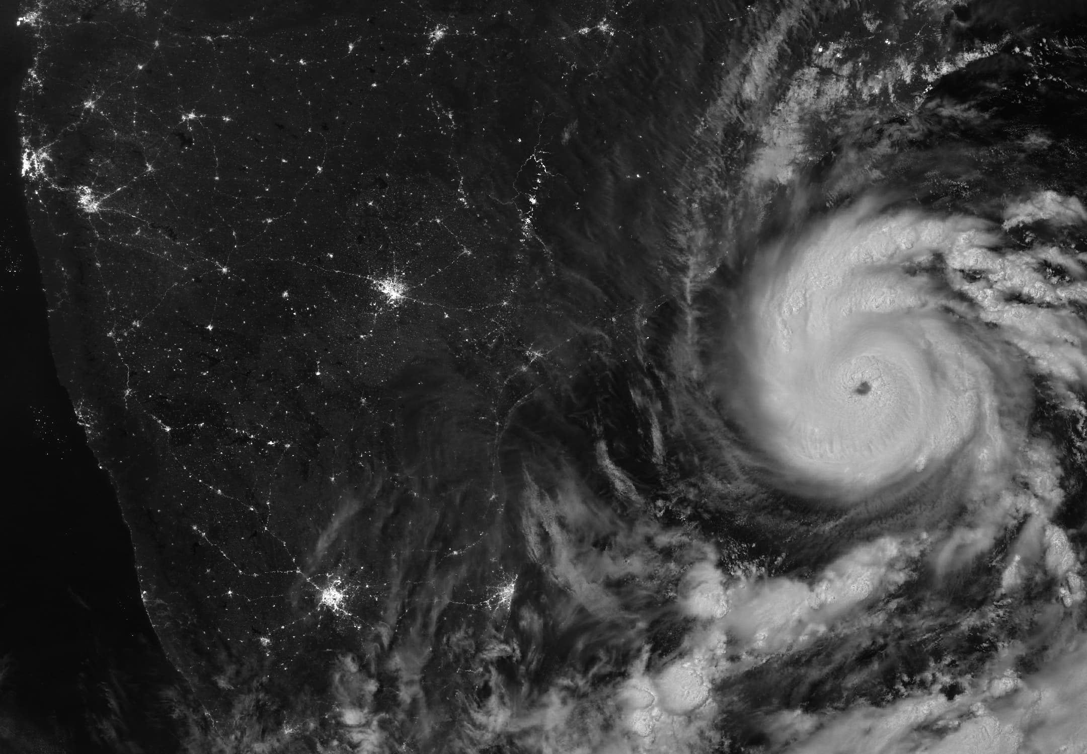
NASA Earth Observatory published a nighttime satellite image of Cyclone Arnab on October 29, 2026, showing its cloud spiral approaching India’s east coast. The scene comes from NOAA-20’s Visible Infrared Imaging Radiometer Suite, or VIIRS, using the instrument’s day-night band.
The satellite acquired the image at 20:12 UTC on October 26 — 1:42 a.m. India Standard Time on October 27. NASA places the observation before Arnab’s landfall on the Andhra Pradesh and Yanam coast early on October 28. City lights are visible on land beside the bright storm clouds.
By 8:30 a.m. IST on October 29, the storm’s remnant had weakened to a depression over south Chhattisgarh and adjoining south Odisha, the India Meteorological Department recorded in its 2:10 p.m. IST bulletin.
The department warned of isolated extremely heavy rainfall over east Chhattisgarh and adjoining north Odisha on October 29, and over north Bihar on October 30.
Reporting trail
Primary sources

For an image post, download the card and copy this suggested caption.
The NOAA-20 observation was taken early on October 27 IST; the IMD’s October 29 bulletin tracked the cyclone’s inland remnant. Read the full report: https://www.spaceexploration.in/news/arnab-nighttime-satellite-observation #SpaceExplorationNews #SpaceNews #SpaceScience