Earth observation
Rwanda’s Planet data programme targets public services and universities
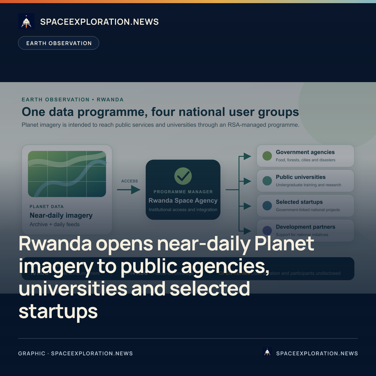
Rwanda Space Agency will manage access to near-daily imagery and an archive for state bodies, public universities, selected startups and development partners. The August 14 newsletter item was follow-on coverage of Planet’s August 10 announcement, not a second programme launch.
Add us as a preferred source on Google Add us as a preferred source on Google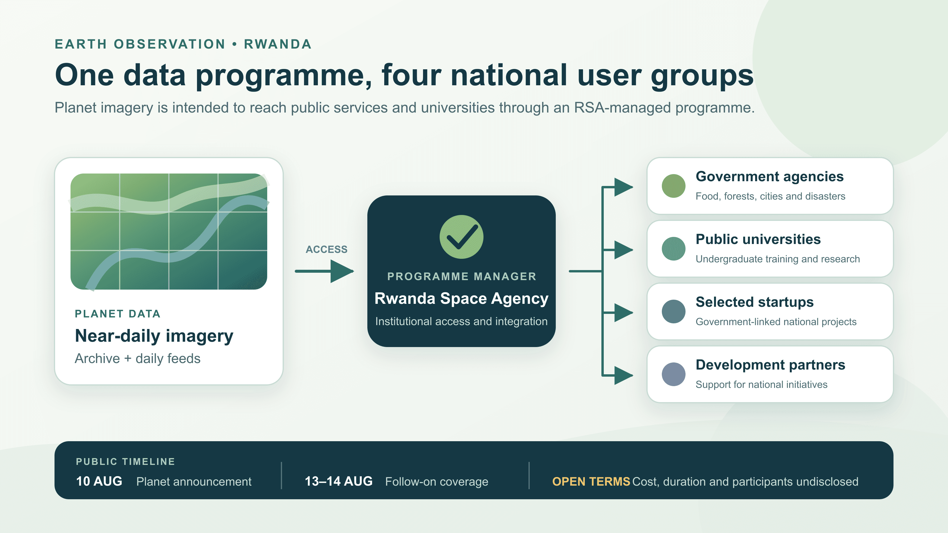
Rwanda and Planet Labs announced a national satellite-data programme on August 10 that is intended to put commercial Earth-observation imagery into government work, university teaching and research, and selected startup projects. Via Satellite published a follow-on story on August 13 and carried it in its August 14 Daily News Feed; those later items did not announce a second agreement. Even the primary material leaves one timing wrinkle: Planet’s press release says the programme was launched on August 10, while its accompanying Planet Pulse article says it had been unveiled in June without giving a date.
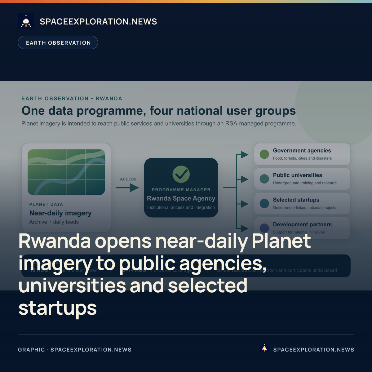
The Rwanda Space Agency, or RSA, will manage the programme. The announced user groups are government agencies, public universities, selected startups and strategic development partners supporting national initiatives. That makes this an access and capacity programme built around data from Planet’s existing fleet, not an announcement that Rwanda is buying or launching a satellite. Neither of Planet’s August 10 publications describes a Rwandan spacecraft, launch service or new ground segment as part of the arrangement.
How the data is meant to reach public services
Planet says government users will draw on its growing archive of near-daily satellite data to monitor agriculture and food security, track forest health and resilience, refine urban planning and zoning, and inform disaster planning, response and recovery. These are stated applications rather than measured results. The announcement provides no completed case study, service-level performance record or evidence that every named public-service workflow was operating by August 10.
Planet’s longer account says RSA will integrate the data across state bodies and public universities and make high-resolution imagery a tool for policy and decision support. Central management could give several institutions a common source of repeat imagery, but the publications do not describe the delivery platform, agency-by-agency permissions or the process for turning images into official decisions. The evidence supports a planned distribution structure; it does not show how each ministry will use it in practice.
The two August 10 publications also use different technical descriptions without identifying the contracted products. The press release refers to a near-daily archive and daily feeds, while Planet Pulse calls the imagery high-resolution. Neither source names a Planet product, spatial resolution, archive start date, guaranteed revisit interval, analytics package or data-residency arrangement. Without those terms, the publications do not establish which operational questions the contracted data can answer.
Universities and startups are part of the delivery model
Public universities are due to receive Planet imagery and data for undergraduate training and advanced Earth-observation research. Planet Pulse adds that the programme is intended to support new courses and degree programmes, framing education as part of the national capacity plan rather than a separate academic subscription. The publications do not identify participating universities, degree providers, student numbers, research grants, teaching licences or a timetable for adding courses.
Selected startups working with government agencies on what Planet calls core national interests are also expected to use the company’s daily feeds. Strategic development partners supporting national initiatives form a fourth user category. Planet did not publish a startup application route, selection criteria, participant count, commercial-use terms or the projects that will receive access. The announcement therefore creates categories of eligible institutions but does not establish that the imagery is openly available to every Rwandan company or researcher.
That distinction limits how broadly the programme can be described. Public-university access is explicit; general public access is not. Selected startups are included; the wider private sector is not promised access. The available documents describe an RSA-managed national programme with targeted institutional users, not an open-data release. Any future public portal, licence or wider eligibility would need its own announcement or published terms.
A public-sector partnership discussed since 2022
The August announcement follows a documented relationship extending back four years. On July 27, 2022, Rwanda’s agriculture minister hosted Planet co-founder and chief executive Will Marshall for talks attended by the ministers responsible for information technology, emergency management and environment, as well as RSA officials. Rwanda’s agriculture ministry said the parties were exploring satellite imagery for environmental, agricultural and disaster management. That meeting shows continuity in the use cases, but it did not set out the terms of the 2026 programme.
RSA’s role also follows its statutory mission. Rwanda’s April 2021 law establishing the agency says its mission is to develop the national space sector for socio-economic development and assigns it responsibility for advising the government on space policy and implementing national and international space strategies. Managing access to commercial Earth-observation data is consistent with that remit, although the August publications do not say which procurement or policy mechanism RSA used for this programme.
Planet describes the Rwanda arrangement as its first national programme of this kind in Africa and says it follows a pilot in Zanzibar supported by the Tony Blair Institute and the World Bank. Via Satellite repeated the first-in-Africa description, but neither publication supplied a definition of national programme or a comparison with other African imagery-access initiatives. The claim is therefore Planet’s characterization, not an independently established continental first.
What the August announcement leaves open
The commercial and implementation terms remain largely undisclosed. The source set gives no contract value, funding source, duration, start-of-service date, list of participating agencies or universities, startup roster, data volume, access limits, procurement route or success measures. It also does not explain whether users receive raw scenes, processed products, analytical tools or training from Planet. Those omissions prevent a judgment about the programme’s cost, coverage or operational maturity.
The core August details come from Planet, a party to the arrangement. Via Satellite independently confirms that it covered the programme after the August 10 announcement, but its short report repeats the same scope and Andrew Zolli statement rather than providing implementation evidence. No operational results were available in the reviewed sources by August 20. The next verifiable step will be the naming of participating institutions, publication of access terms, or documented use of Planet data in a Rwandan public service or university course.
Reporting trail
Primary sources
Planet Labs PBC via Business WirePlanet Labs and the Government of Rwanda Launch First-of-its-Kind National Satellite Data Program in Africagreenstocknews.com
Planet PulseEmbracing Digital Transformation in Africa: Planet and the Government of Rwanda Launch National Satellite Data Programplanet.com
Via SatellitePlanet Labs to Support Government, Public Services in Rwandasatellitetoday.com
Via SatelliteDaily News Feed – 08-14-26satellitetoday.com
Rwanda Ministry of Agriculture and Animal ResourcesRwanda and Planet Labs discuss use of satellite imagery data for Rwandaminagri.gov.rw
Official Gazette of RwandaLaw N° 019/2021 of 16/03/2021 Establishing Rwanda Space Agencyspace.gov.rw
For an image post, download the card and copy this suggested caption.
Rwanda Space Agency will manage access to near-daily imagery and an archive for state bodies, public universities, selected startups and development partners. The August 14 newsletter item was follow-on coverage of Planet’s August 10 announcement, not a second programme launch. Read the full report: https://www.spaceexploration.in/news/rwanda-planet-national-satellite-data-programme #SpaceExplorationNews #SpaceNews #SpaceIndustry