Earth observation
Landsat traces a 17-square-kilometre iceberg into Denmark Strait
NASA followed the berg more than 1,000 kilometres from northeast Greenland, but satellite clues do not settle whether it came from Zachariæ Isstrøm or a remnant ice shelf.
Add us as a preferred source on Google Add us as a preferred source on Google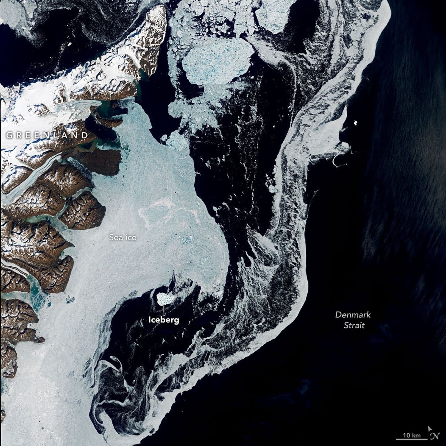
NASA has traced a roughly 17-square-kilometre iceberg from northeastern Greenland into the Denmark Strait using Landsat imagery, reconstructing a southward journey of more than 1,000 kilometres while leaving the berg’s exact birthplace unresolved. The agency published its account on August 20, after following the object through spring and summer scenes. By mid-August, it was about 1,500 kilometres from the bay where specialists think its drift began and was already coming apart.
The clearest measurement came from June 12, when Landsat 9’s Operational Land Imager captured the iceberg just south of Kangikajiip Appalia on Greenland’s east coast, between Greenland and Iceland. NASA calculated its surface area at about 17 square kilometres, or 7 square miles. It stood out as a bright white mass among sea ice and smaller berg fragments in a mixed field known as mélange, with blue meltwater ponds visible across its surface.
A track assembled from uneven clues
Identifying the object earlier in the year was harder than measuring it in open water. Through spring, sea ice and berg fragments crowded Jøkelbugten and the nearby coast. Snow could make their surfaces similarly bright in satellite images, and a late-May Landsat view contained many plausible look-alikes. Only after the large berg moved south and the surrounding ice thinned did it become easy to pick out across successive scenes. The track is therefore a reconstruction, not an unbroken observation.
Size, colour and setting helped distinguish the mass from old sea ice. Alexis Denton, an oceanographer and chief scientist with the International Ice Patrol, pointed to its closeness to shore, its whiter appearance and its larger footprint relative to surrounding floes. Those cues supported treating it as a calved iceberg. NASA compared its June 12 area with about five Central Parks, while noting that it remained modest beside the largest bergs released by Antarctic glaciers and ice shelves.
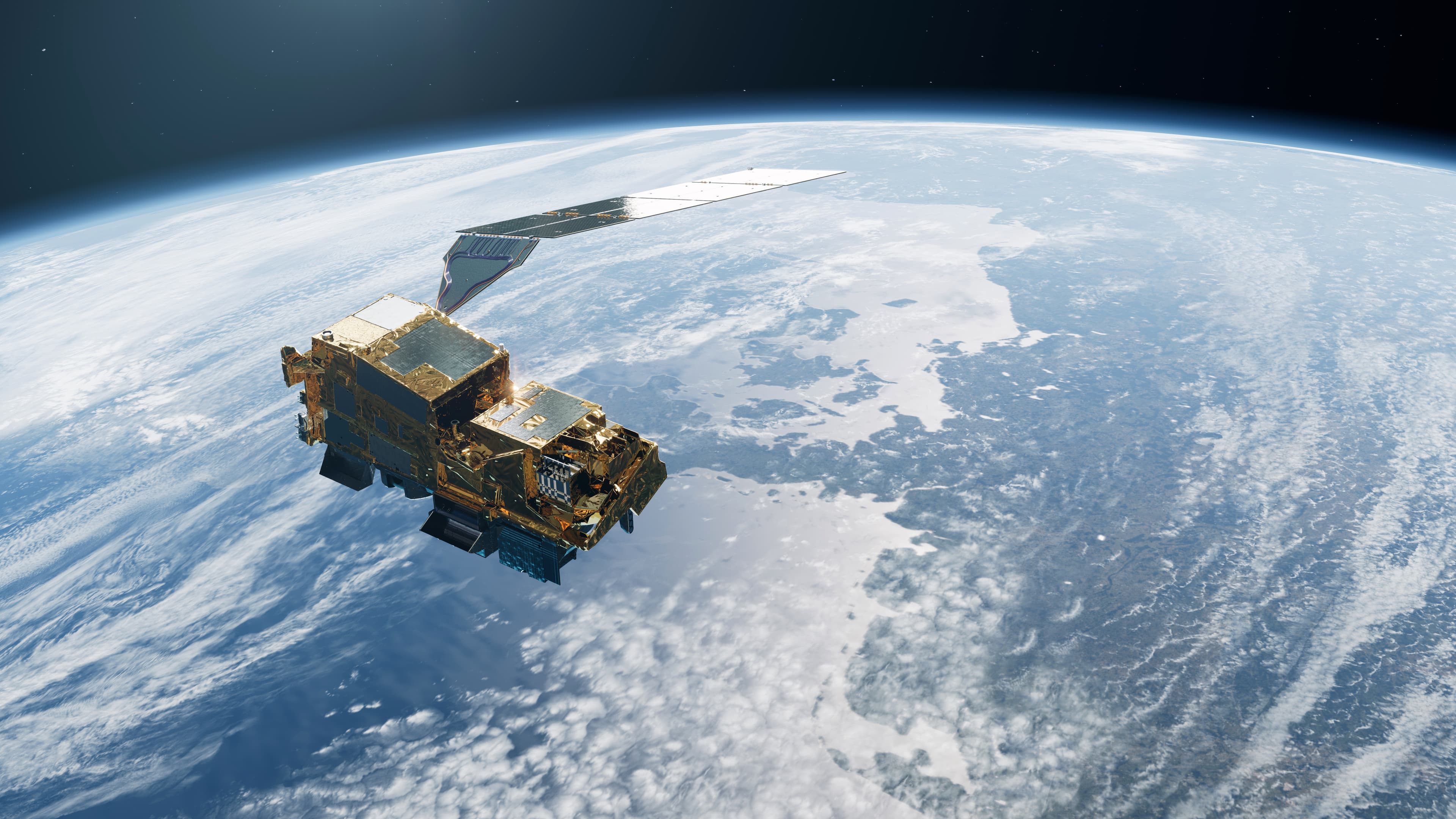
The Operational Land Imager observes Earth in visible, near-infrared and shortwave-infrared bands. The U.S. Geological Survey says Landsat 9 follows a 16-day repeat cycle and flies eight days out of phase with Landsat 8; together the satellites add nearly 1,500 scenes a day to the archive. Those mission characteristics help a dated sequence to be assembled, but do not guarantee a usable view each time: cloud, snow, sea ice and look-alike fragments still determine whether an individual berg can be recognised.
The bay is known; the source is not
Keld Quistgaard, a senior ice adviser with the Danish Meteorological Institute’s Greenland Ice Service, placed the iceberg’s origin in Jøkelbugten, a bay in northeastern Greenland. The narrower attribution remains open. NASA’s account names Zachariæ Isstrøm and an adjacent remnant ice shelf as possibilities, but neither expert testimony nor the image sequence identifies a calving event that can be matched definitively to the June object. The route can be followed more confidently than the moment the berg separated.
Christopher Shuman, a retired University of Maryland glaciologist, favours the remnant shelf. His case rests on several visible clues: the berg’s size, its dense pattern of meltwater ponds, and its resemblance to shelf ice seen in earlier satellite images. Shuman said icebergs calved directly from Zachariæ Isstrøm usually tend to be smaller. He also cited older imagery showing pieces of remnant shelf ice drifting south and becoming trapped among islands near the bay, where winds and tides could move them for years.
That is a hypothesis, not a source assignment. Large size and a ponded surface can narrow the possibilities without recording which ice front released the berg or when. Spring snow makes the retrospective search harder, and a piece stored among islands may separate long before it finally enters a clear southward drift. NASA left the source glacier unresolved, so describing the iceberg as definitely calved from Zachariæ Isstrøm would go beyond the evidence.
The candidate region has a documented history of change. A NASA Earth Observatory account published in 2015 said Zachariæ Isstrøm left a stable position in 2012 and entered accelerated retreat. Landsat comparisons from 1999 and 2015 showed substantial retreat of the glacier and its shelf, while a 26-image sequence tracked the 2015 melt season. That history establishes why both active glacier ice and stranded shelf remnants are plausible candidates; it does not resolve the lineage of the 2026 iceberg.
South through Denmark Strait
By June 12, the berg had reached the strait between Greenland and Iceland, amid a broad belt of sea ice along the Greenland coast. The image date matters: NASA’s story arrived more than two months later, after analysts could compare the scene with earlier and newer observations. The August 20 publication is therefore a tracking account assembled from prior imagery, not notice of an iceberg first detected that day.
NASA reported that the iceberg continued south on the Greenland Coastal Current. By mid-August it was about 1,500 kilometres, or 900 miles, from Jøkelbugten. Quistgaard expected it to disintegrate progressively during August, and NASA said recent satellite views showed that process under way. The account did not give a final breakup date, a surviving-fragment count or a precise endpoint, leaving the berg’s later condition open to further imagery.
The expected breakup also changes the navigation question. NASA reported that disintegration in Denmark Strait would make remnants unlikely to enter the busier shipping routes around Greenland’s southern tip. That is a forecast based on where the berg was breaking apart, not a confirmed final track for every fragment. The 2026 track and expert assessments here rely on NASA’s August 20 account; no independent field identification of the iceberg was available for this article. The imagery settles the object’s scale and broad path; until a scene can be tied to a specific calving or shelf-separation event, Jøkelbugten remains the supported origin area and the remnant shelf remains an informed but unconfirmed explanation.
Reporting trail
Primary sources
For an image post, download the card and copy this suggested caption.
NASA followed the berg more than 1,000 kilometres from northeast Greenland, but satellite clues do not settle whether it came from Zachariæ Isstrøm or a remnant ice shelf. Read the full report: https://www.spaceexploration.in/news/landsat-greenland-iceberg-denmark-strait #SpaceExplorationNews #SpaceNews #SpaceScience